Videos
Introducing 360° Mesh Data Generation
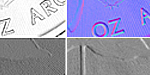
Now users can transform multiple 3D point clouds into “meshed” surface data for use in high-precision shape measurement and inspection. Mesh data consists of interconnected data points that form a continuous, 360º surface representing the object’s complete geometry that leverages high accuracy 6DoF alignment for wide and ring-type multi-sensor layouts. Users can then apply any of Gocator’s built-in Surface tools to perform advanced measurements on the meshed surface.
Certified System Integrator Program
Set Yourself at the Forefront of the Global Vision Market
.jpg) Vision system integrators certified by A3 are acknowledged globally throughout the industry as an elite group of accomplished, highly skilled and trusted professionals. You’ll be able to leverage your certification to enhance your competitiveness and expand your opportunities.
Vision system integrators certified by A3 are acknowledged globally throughout the industry as an elite group of accomplished, highly skilled and trusted professionals. You’ll be able to leverage your certification to enhance your competitiveness and expand your opportunities.
LMI Technologies Inc.
With a single software platform unifying 2D, 3D, edge, and scalable system architectures, LMI helps manufacturers reduce complexity, improve uptime, and future-proof their inspection strategy. To learn more, visit www.lmi3d.com or contact [email protected].
Discover how LMI Technologies Inc. can support your automation journey with their complete range of solutions and expertise.
Visit Company Website

With a single software platform unifying 2D, 3D, edge, and scalable system architectures, LMI helps manufacturers reduce complexity, improve uptime, and future-proof their inspection strategy. To learn more, visit www.lmi3d.com or contact [email protected].

Fast 100% Inline Print Inspection for the Packaging Industry
Packaging is fundamentally used for the protection and transportation of products. However, packaging also features colorful "buy me!" advertising messages.